![]()
PREMIUM LOGIN
ClassTools Premium membership gives access to all templates, no advertisements, personal branding and many other benefits!
| Username: | ||
| Password: | ||
|
Submit
Cancel
|
||
| Not a member? | ||
![]()
PREMIUM LOGIN
ClassTools Premium membership gives access to all templates, no advertisements, personal branding and many other benefits!
| Username: | ||
| Password: | ||
|
Submit
Cancel
|
||
| Not a member? | ||
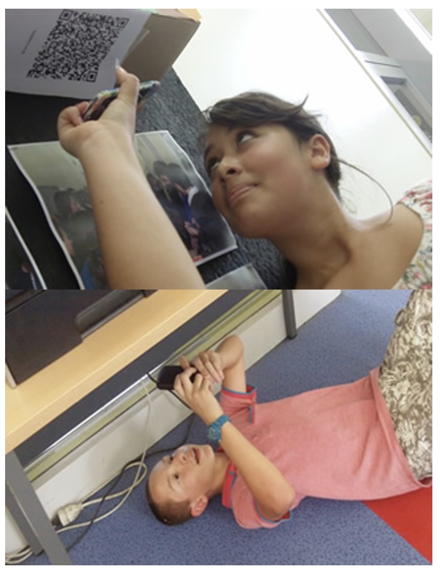
1. Arrange students into groups. Each group needs at least ONE person who has a mobile device.
2. If their phone camera doesn't automatically detect and decode QR codes, ask students to
4. Cut them out and place them around your class / school.
1. Give each group a clipboard and a piece of paper so they can write down the decoded questions and their answers to them.
2. Explain to the students that the codes are hidden around the school. Each team will get ONE point for each question they correctly decode and copy down onto their sheet, and a further TWO points if they can then provide the correct answer and write this down underneath the question.
3. Away they go! The winner is the first team to return with the most correct answers in the time available. This could be within a lesson, or during a lunchbreak, or even over several days!
4. A detailed case study in how to set up a successful QR Scavenger Hunt using this tool can be found here.
Question | Answer |
| 1. When was Google Street View launched? | 2007 | 2. Streets with Street View imagery are available when _______ _______ are shown on Google Maps. | blue lines | 3. Most Google Street View pictures are done by car but what 6 other ways are mentioned? | trekker, tricycle, walking, boat, snowmobile, and underwater cameras | 4. Fill in the missing word. Can you guess what it might mean? : A user can switch to the old version of Google Maps, which is especially useful when Google Maps is more ________ than usual. | sluggish, meaning slow | 5. What two things will Google Street View automatically blur? | faces and licence plates (cars) | 6. In which two countries has Google Street View had to lower the height of its cameras? Why? | Japan and Switzerland, the cameras were looking over into peoples’ gardens | 7. In which country was Google Street View banned? | Austria | 8. Fine-art photographers have selected images for use in their own work. What two adjectives are used to describe the images? | pixelated and muddy | 9. In 2012, Google announced it had captured __ petabytes of data for Google Street View. | 20 | 10. What and where were panoramic views taken under water? | West Nusa Tenggara, underwater coral |
![]()
Question 1 (of 10)
![]()
Question 2 (of 10)
![]()
Question 3 (of 10)
![]()
Question 4 (of 10)
![]()
Question 5 (of 10)
![]()
Question 6 (of 10)
![]()
Question 7 (of 10)
![]()
Question 8 (of 10)
![]()
Question 9 (of 10)
![]()
Question 10 (of 10)