PREMIUM LOGIN

ClassTools Premium membership gives access to all templates, no advertisements, personal branding and other benefits!

Username:    
Password:    
Submit Cancel


Not a member? JOIN NOW!  

QR Challenge: Geography Unit 2 Review

Created using the ClassTools QR Treasure Hunt Generator

Teacher Notes

A. Prior to the lesson:

1. Arrange students into groups. Each group needs at least ONE person who has a mobile device.

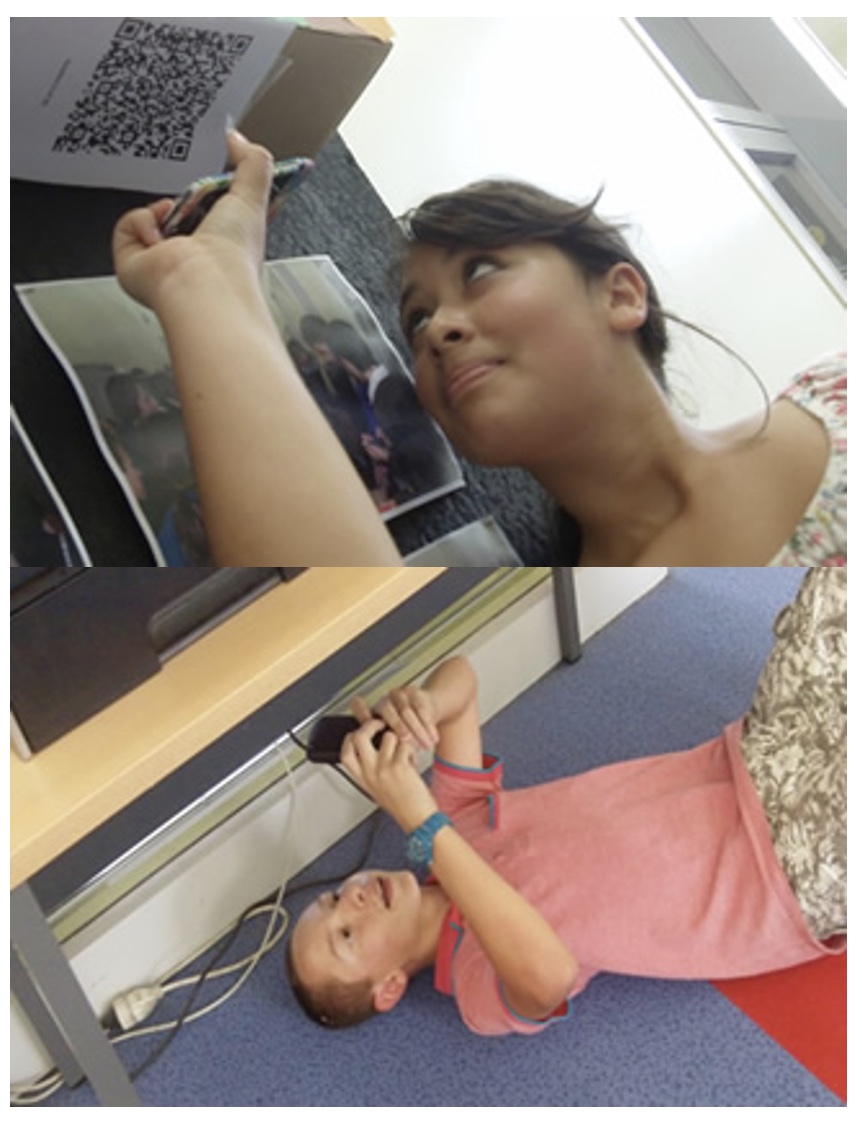
2. If their phone camera doesn't automatically detect and decode QR codes, ask students to

3. Print out the QR codes.

4. Cut them out and place them around your class / school.


B. The lesson:

1. Give each group a clipboard and a piece of paper so they can write down the decoded questions and their answers to them.

2. Explain to the students that the codes are hidden around the school. Each team will get ONE point for each question they correctly decode and copy down onto their sheet, and a further TWO points if they can then provide the correct answer and write this down underneath the question.

3. Away they go! The winner is the first team to return with the most correct answers in the time available. This could be within a lesson, or during a lunchbreak, or even over several days!


C. TIPS / OTHER IDEAS

4. A detailed case study in how to set up a successful QR Scavenger Hunt using this tool can be found here.


Questions / Answers (teacher reference)

Question

Answer

1. How many compass points are on a compass rose?16
2. When measuring a bearing (angle), which direction do we point the 0 degrees to on our protractor?North
3. Do large scale maps show a large or small area?Small
4. Which type of scale uses words to describe the relationship between a distance on a map and a specific distance on the Earth's surface? (Direct Statement Scale, Linear Scale or RF Scale)Direct Statement Scale
5. How many centimetres are in a kilometre?100, 000 (one-hundred thousand)
6. 1 : 50, 000 = 1 cm represents ______________ km0.5
7. What is the symbol that represents a hospital?H
8. On military grids, what is each vertical line called?An easting
9. When reading military grids, what do 'The 3 R's' stand for?Read Right, Read Up
10. Which way do latitudinal lines run on a map?East-West
11. Which line runs at 23.5 degrees North Latitude?Tropic of Cancer
12. How many degrees is the International Date Line located at?0 degrees longitude
13. What Hemisphere are places to the 'left' of the Prime Meridian located in?Western Hemisphere
14. Where are meridians spaced furthest apart? (At the poles or at the equator)Equator
15. All Canadian time zones are 1 hour apart, except for one, which is a half an hour difference. Which zone is this?Newfoundland
16. If it is 12:00 pm in Vancouver, what time is it in Ottawa?3:00 pm
17. When contour lines are closer together, is the hill a gentler slope or a steeper slope?Steeper
18. What type of pattern/letter do contour lines create when crossing a stream or slope?V
19. If you were walking along a beach, exactly where the water meets the land (sea level), what would your elevation be?0
20. If you are looking at a cross profile view of a hill are you viewing it from the side or from above?Side view


Geography Unit 2 Review: QR Challenge

https://www.classtools.net/QR/decode.php?text=How_many_compass_points_are_on_a_compass_rose?

Question 1 (of 20)


Geography Unit 2 Review: QR Challenge

https://www.classtools.net/QR/decode.php?text=When_measuring_a_bearing_(angle),_which_direction_do_we_point_the_0_degrees_to_on_our_protractor?

Question 2 (of 20)


Geography Unit 2 Review: QR Challenge

https://www.classtools.net/QR/decode.php?text=Do_large_scale_maps_show_a_large_or_small_area?

Question 3 (of 20)


Geography Unit 2 Review: QR Challenge

https://www.classtools.net/QR/decode.php?text=Which_type_of_scale_uses_words_to_describe_the_relationship_between_a_distance_on_a_map_and_a_specific_distance_on_the_Earth's_surface?_(Direct_Statement_Scale,_Linear_Scale_or_RF_Scale)

Question 4 (of 20)


Geography Unit 2 Review: QR Challenge

https://www.classtools.net/QR/decode.php?text=How_many_centimetres_are_in_a_kilometre?

Question 5 (of 20)


Geography Unit 2 Review: QR Challenge

https://www.classtools.net/QR/decode.php?text=1_:_50,_000_=_1_cm_represents________________km

Question 6 (of 20)


Geography Unit 2 Review: QR Challenge

https://www.classtools.net/QR/decode.php?text=What_is_the_symbol_that_represents_a_hospital?

Question 7 (of 20)


Geography Unit 2 Review: QR Challenge

https://www.classtools.net/QR/decode.php?text=On_military_grids,_what_is_each_vertical_line_called?

Question 8 (of 20)


Geography Unit 2 Review: QR Challenge

https://www.classtools.net/QR/decode.php?text=When_reading_military_grids,_what_do_'The_3_R's'_stand_for?

Question 9 (of 20)


Geography Unit 2 Review: QR Challenge

https://www.classtools.net/QR/decode.php?text=Which_way_do_latitudinal_lines_run_on_a_map?

Question 10 (of 20)


Geography Unit 2 Review: QR Challenge

https://www.classtools.net/QR/decode.php?text=Which_line_runs_at_23.5_degrees_North_Latitude?

Question 11 (of 20)


Geography Unit 2 Review: QR Challenge

https://www.classtools.net/QR/decode.php?text=How_many_degrees_is_the_International_Date_Line_located_at?

Question 12 (of 20)


Geography Unit 2 Review: QR Challenge

https://www.classtools.net/QR/decode.php?text=What_Hemisphere_are_places_to_the_'left'_of_the_Prime_Meridian_located_in?

Question 13 (of 20)


Geography Unit 2 Review: QR Challenge

https://www.classtools.net/QR/decode.php?text=Where_are_meridians_spaced_furthest_apart?_(At_the_poles_or_at_the_equator)

Question 14 (of 20)


Geography Unit 2 Review: QR Challenge

https://www.classtools.net/QR/decode.php?text=All_Canadian_time_zones_are_1_hour_apart,_except_for_one,_which_is_a_half_an_hour_difference.__Which_zone_is_this?

Question 15 (of 20)


Geography Unit 2 Review: QR Challenge

https://www.classtools.net/QR/decode.php?text=If_it_is_12:00_pm_in_Vancouver,_what_time_is_it_in_Ottawa?

Question 16 (of 20)


Geography Unit 2 Review: QR Challenge

https://www.classtools.net/QR/decode.php?text=When_contour_lines_are_closer_together,_is_the_hill_a_gentler_slope_or_a_steeper_slope?

Question 17 (of 20)


Geography Unit 2 Review: QR Challenge

https://www.classtools.net/QR/decode.php?text=What_type_of_pattern/letter_do_contour_lines_create_when_crossing_a_stream_or_slope?

Question 18 (of 20)


Geography Unit 2 Review: QR Challenge

https://www.classtools.net/QR/decode.php?text=If_you_were_walking_along_a_beach,_exactly_where_the_water_meets_the_land_(sea_level),_what_would_your_elevation_be?

Question 19 (of 20)


Geography Unit 2 Review: QR Challenge

https://www.classtools.net/QR/decode.php?text=If_you_are_looking_at_a_cross_profile_view_of_a_hill_are_you_viewing_it_from_the_side_or_from_above?

Question 20 (of 20)